
| Conival | 987m (3238 ft) OS Sheet 15; NC 303199 |
| Ben More Assynt | 998m (3274 ft) OS Sheet 15; NC 318202 |
| Our Ascent: | 18 August 1994 |
These two summits are the highest points on the long high ridge that runs the almost entire length of Assynt's eastern boundary. Ben More Assynt is hidden from the road by Conival and can only be picked out when viewed from other mountains, or when seen as part of the entire ridge from a substantial distance. Generally the two peaks are tackled together by a days expedition starting and finishing at the Inchnadamph Hotel on the main road. An alternative is to tackle the entire ridge between Glas Bheinn in the north and Breabag in the south. The latter top gives the best views of the extensive ridges to Ben More hidden on the East side of the mountain.
Most guide books describe the ascent from Inchnadamph Hotel that we
tackled below. By way of an extension the walk can be continued south east from
Ben More to the outlying top - this involves a narrow, rocky and exposed
traverse. From here descend to Dubh Loch Mor and traverse around Conival's
slopes to regain the route back to Inchnadamph.
The day started with bright skies and warm sunshine and after a 40 min drive from Achiltilbuie we parked the car at the new car park by the road; we were walking by 10:40. The walk up the River Traligill was further than anticipated and it took longer to reach the head on the valley; we did not linger to explore the caves. The climb by the stream to reach the col to the west of Conival was steep with grass and peat - extremely wet and slippery in places. Near the top a band of rock 20 ft high runs across the valley with a substantial stream falling over it. It was 12:40 and with Andrew still complaining of the necessity to climb mountains, time for a chocolate bar and drink.
Above the rock band, easily ascended, the terrain changes to one of shattered quarzite and a very wild landscape. We climbed the steep scree slope up the north ridge of Conival, followed by a half kilometre level ridge walk to the summit cairn. The position is high above the general level of the surrounding hills and gives panoramic views - particularly to the west where all the hills of Assynt and Coigach can be picked out. The mountains were mostly clear but the cloud level was only just clearing the tops and the promised rain was blowing in from the west rapidly.
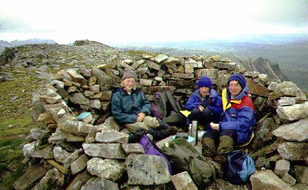
We lunched at 2.00pm by the summit cairn of Conival. The cairn has been built into a circular stone shelter (there are plenty of stones about!) around what used to be a trig point. All that remains is a concrete base with a marking stud in the centre; a triangle has been drawn around the stud marking a clear representation of the symbol used on OS maps.
 The ridge west to Ben More
Assynt stretches out towards the wilderness and looks deceptively close,
however the 1.5 km took nearly an hour to complete. The traverse starts with a
steep descent and the ridge narrows considerably in places with a few ups and
downs, but it was the shattered and loose rocks that slowed us considerably. We
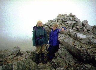
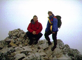
got to the top of our second Munro just as the clouds closed in and the view
disappeared. Quick photos of the cairns - there are two tops and we clambered
up both just to be sure - and we then returned along the ridge, the light rain
now falling making the quartzite rocks slippery and hampering progress further.
Susan lost her hat on the outward leg of this ridge - a grey balaclava dropped
on grey rocks in mist made it impossible to find on the return leg. We later
replaced it with an orange version to prevent a similar loss in the future.
Back over the summit of Conival we had to drop to 2200 ft before we were out of
cloud and back at the top the col.
The ridge west to Ben More
Assynt stretches out towards the wilderness and looks deceptively close,
however the 1.5 km took nearly an hour to complete. The traverse starts with a
steep descent and the ridge narrows considerably in places with a few ups and
downs, but it was the shattered and loose rocks that slowed us considerably. We
got to the top of our second Munro just as the clouds closed in and the view
disappeared. Quick photos of the cairns - there are two tops and we clambered
up both just to be sure - and we then returned along the ridge, the light rain
now falling making the quartzite rocks slippery and hampering progress further.
Susan lost her hat on the outward leg of this ridge - a grey balaclava dropped
on grey rocks in mist made it impossible to find on the return leg. We later
replaced it with an orange version to prevent a similar loss in the future.
Back over the summit of Conival we had to drop to 2200 ft before we were out of
cloud and back at the top the col.
It was now 5.00 pm and - at last - we reached the softer grass slopes. We disturbed a herd of deer to the right on Beinn an Fhurain and did our best to avoid the worst of the bogs. The rain fell more heavily as we descended the valley and we got wet through despite the full waterproofs. It was 7.00pm as we walked into the car park - somewhat thankful to bring the walk to a conclusion.
We changed clothes and moved the car into the car park of the Inchnadamph Hotel where we ordered supper; the children ate sausage and chips whilst we enjoyed venison with vegetables and gravy - treat when camping. We had met several parties on the mountain - the Munro status attracting more than the other summits in the area - and we met most of them in the bar. This included two lads we had met earlier in the holiday on Stac Pollaidh, and who were most impressed with the efforts of the children.
It had been a long and arduous day - 11 miles and 3700 ft of ascent
(work out the metric equivalents for yourself) with the rough going on the tops
and the adverse weather making it one of the hardest walks tackled to date. The
conquoring of these two summits completed the ascent of most of the major
mountains in the areas of Assynt and Coigach, and future holidays would explore
other areas of the Scottish west coast. It was to be 2001 before we returned to
explore other tops and valleys in the region.
![]()
![]()
![]()