| Glendhu | OS Sheet 15; NC 295338 |
| Kylestrome | OS Sheet 15; NC 218345 |
| Our Visit: | 4 August 2001 |
We had long reckoned on a potential walk into the remote area to the east of Kylesku and Kylestrome - the lochs of Glendhu and Glencoul. With the weather for the week very changeable we opted for a day walk to explore the area when the main tops around Quinag and Inchnadamph were well under cloud. The guidebooks offer a few routes up mountains in this area - most notably The Stack above Glen Coul, and Beinn Leoid in heart of this very remote region. Needless to say the texts emphasis the long distances to be covered, much of it over very rough and pathless terrain. Beinn Leoid reaches a height of 792 m (2598 ft) and therefore attracts some attention as it is listed as a Corbett. That aside the only tourists will be devoted walkers in search of some serious solitude.
The old road to the pier at Kylestrome is now closed to public traffic and a new car park has been installed just above the turn off from the main road. We had stopped off for a short walk on an earlier visit but we had done little more than have a picnic lunch beside the lochside. On this visit we were determined to make a more thorough exploration of the area.
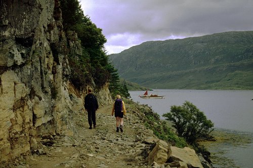
Walking past the entrance to the main house take the track through the trees on the left just before the old road crosses to an island on its way to the pier head. At the time of our visit some tree felling was underway in the local vicinity. Through the trees the lochside is reached at a large iron gate. The path ahead follows the shoreline giving fine views ahead along both sea lochs, and back across to Kylesku and the road bridge. A splendid yacht was anchored in the sheltered bay.
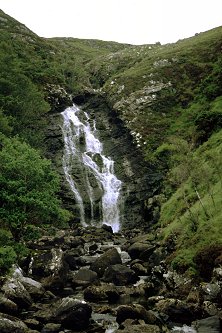
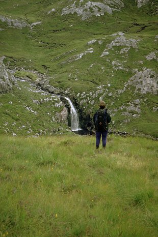
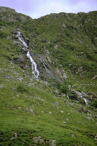
The track passes below some shoreline cliffs. The old narrow track we noted on an earlier visit has now been widened and upgraded with some significant re-modelling of the hillside. The way is easy going, past a small block building (part of the estates electricity supply?) to a junction just below a waterfall at Maldie Burn. The river here is bridged and a small stone building (similar in design to that passed earlier) houses a running hydro-generator - the power unit was built in 1926 and still running strong! We left a couple behind as they set up a tripod to photograph the falls.
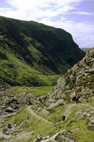
From the falls, the upper path can be followed up to the large lochan Loch an Leathiad Bhuain above the waterfalls, then climb to the 1000 ft contour to pick up a higher return path to Kylestrome - making a pleasant shorter round. Our route followed the shoreline of Loch Glendhu - with some sharp rises and falls under the cliffs. Again this has all been hacked out and widened recently and we passed the machinery (idle as it was a Sunday) some 1 km short of the head of the loch. At this point a cliff of shattered brown rock descends to the shoreline and the original track picks its way along a narrow ledge by means of some impressive abutment building under the rocks. Once the mechanical diggers have completed their construction this is likely to be lost under a more simplistic and brutish means of construction.
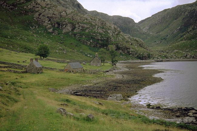
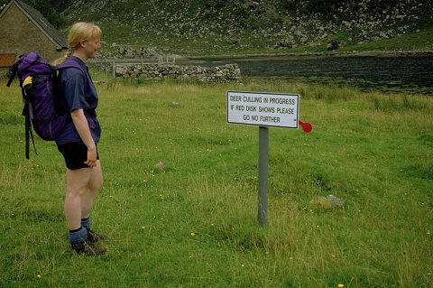
Just at the head of the loch are three fine buildings. The first is a truely excellant bothy - two up and two down - recently restored (1999) with the generous support of The Estate. There is also a barn and a house, the latter fitted with recently installed window frames. Two ponies occupied the paddock and a sign warns of closure of the estate when stalking is in progress - a red tag attached to the sign is used to indicate when shooting is in progress. We met a lone walker here - the only other person we saw after passing the waterfall - who had spent all weekend in the area with some friends. We read the log book and added our own entry before pushing on up the valley. Reference is made to a second, equally impressive, bothy around the coast at Glencoul. The map shows a path climbing the headland between the two lochs from the Glencoul side. An outcrop of rock runs up diagonally from the Loch Glendhu side and this looks to be a feasible line of attack from this side; the river is bridged just above sea level.
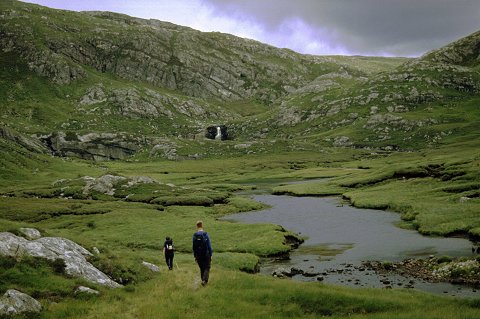
Beyond the head of the loch the valley is flat for the next kilometre. The track passes through an old enclosure; wire mesh baskets have been used to create fish ladders in the river. At the head of the valley the track finally gives way to a path and this climbs in well constructed zig-zags to reach the rocky lip above. To the right a long and impressive cascade falls from the high ridge above. Once the lip has been gained the valley flattens out with a small lochan surrounded by boggy ground; a sizeable waterfall comes into view at the far side. The path skirts the boggy ground to the north and divides just before a bridge crosses the main river. The wooden hand rails have been worn into a curious shape - presumably by the deer.
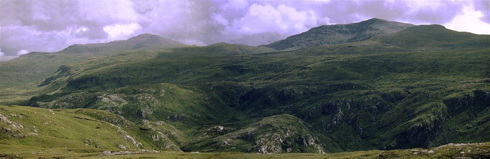
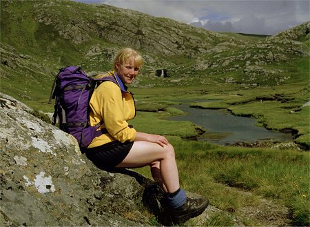
The main path continues for a further kilometre to the northern slopes of Beinn Leoid ending at the 400 m contour - still two and a half kilometres short and 500m below the final summit. We chose to explore the second branch, passing in front of the falls and climbing sharply again in constructed zig-zags to the hill side above. The path ends besides one of a string of lochans and we settled down for some lunch in the sunshine sitting on a nearby knoll. This gave extensive views of Beinn Leoid and its neighbours with fine views up the wide valley. The far side of this valley can be reached by another path coming from the north at Loch More on the Lairg road. Beyond this the Ben Hee range can be seen to the east. The tops of the Inchnadamph hills and Quinag were still shrouded in mist - our modest height of about 1000ft limited our view to the adjacent hills.
 As the sun disappeared behind the
clouds we packed our rucksacks and retraced our steps back down the valley. As
height was lost the valley sides closed in and restricted the views - but the
crags and waterfalls provided ample interest. An otter was seen in the bay as
we passed the house at Glendhu. It is then a steady walk out along the
shoreside track to the car. We got caught by a very heavy shower just before we
got back to the car. We then retired for an excellant supper at the hotel just
across the bridge in Klyesku.
As the sun disappeared behind the
clouds we packed our rucksacks and retraced our steps back down the valley. As
height was lost the valley sides closed in and restricted the views - but the
crags and waterfalls provided ample interest. An otter was seen in the bay as
we passed the house at Glendhu. It is then a steady walk out along the
shoreside track to the car. We got caught by a very heavy shower just before we
got back to the car. We then retired for an excellant supper at the hotel just
across the bridge in Klyesku.
![]()
![]()
![]()