| Name of Top: | Sron Gharbh |
| Height: | 849m (2787 ft) |
| Map Reference: | OS Sheet 15; NC 162119 |
| Our Ascents: | August 1991 9 August 1999 30 July 2001 |
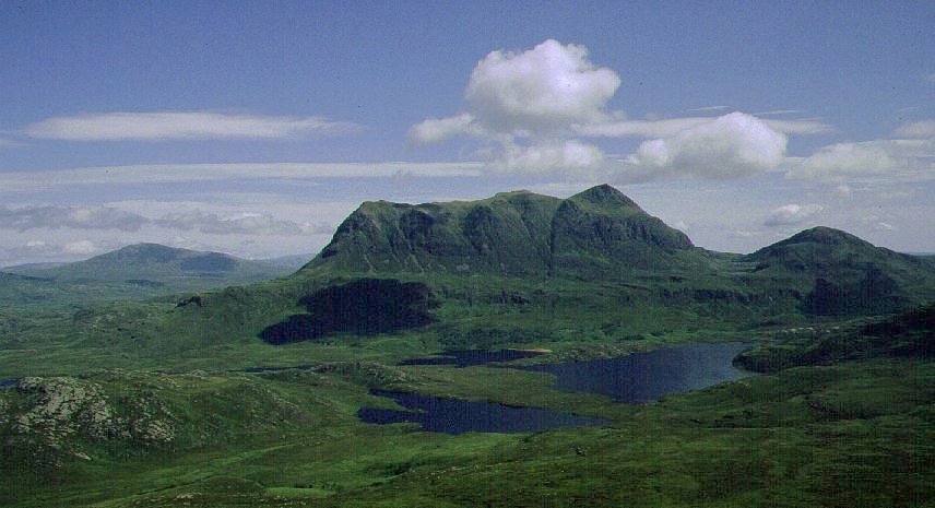
Cul Mor fills the north west corner of Coigach showing a distinctive profile of twin summits when seen from the east. This is the highest mountain in the district and provides an excellant viewpoint for the more northerly hills of Suilven, Canisp and Benmore Forest. The western aspect of the mountain is much more complex and is best viewed from the top of Stac Pollaidh, just over 5km to the west. Many guidebooks propose a walk that embraces both this mountain and its near neighbour Cul Beag - which makes for a long day and the need to cover some rough terrain between the two peaks. In either case the mountain is not particularly popular and you are unlikely to meet many others on the slopes.
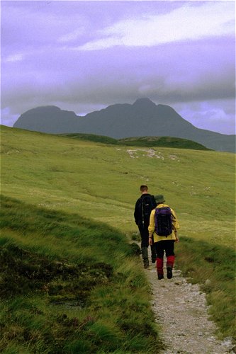
The shortest routes are from the east, leaving the A835 road on a stalkers path just north of the visitor centre at Knockan Cliff. The path is wet in places but easily followed as it leads up on to the shoulder of the mountain - further than is shown on the OS map. To complete the climb you can turn north to pick up the north east ridge, over Meallan Diohain, or strike east to the obvious col between the main top and the southern top of Creag nan Calman. For routes from the west and Cul Beag see the second ascent route given below.
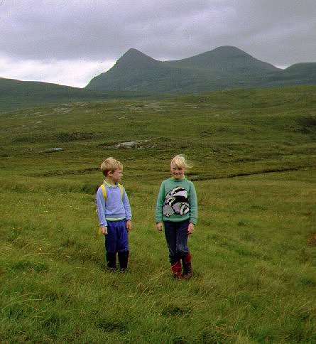
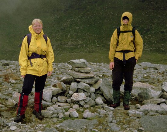
It was an overcast day when we set out along the path from Knockan. It is a longish walk in with a steep climb over heather slopes to gain the lip of the corrie. Beyond this there was no clear path to follow - or we missed it if there is one - and it was a tedious scramble over steep and wet grass slopes to reach the col. The children found it very tiring. The southern top was clear of cloud and after a debate we tackled the 100m scramble up the rocky summit cone to the top - much more easily conquered than the slopes lower down. We sheltered around the cairn with the clouds skimming just above the summit height.
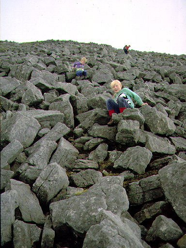
For the return we dropped down the north east ridge; the slope is a large boulder field and the children thoroughly enjoyed themselves scrambling over them - using their seat as much as their hands and feet. The ridge over Meallan Diomhain is flat and easy going, the route then dropping over grassy slopes to pick up the top end of the stalkers path used on the ascent. It was late afternoon by the time we got back to the car and, as the wind had dropped, the midges were rampant. It had been a long and hard day for the two children.
We had long wanted to explore the area between Stac Pollaidh and Cul Mor - an area dominated by a series of lochs and much less frequently walked than the more direct routes. In 1999 we were back in the area and with the weather set fair we decided to tackle the ascent of Cul Mor from the west.
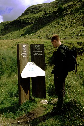
The stalkers path that gives direct access into the interior starts from the road at a small clump of trees few few hundred yards east of the house of Linneraineach; there is space for parking a few cars just beyond the house. The path sports a welcome/map display board and a post cemented into the ground - the purpose of the latter is not known. The map gives a pictoral 3-d image of the area, shows where you are standing but gives no more information than that shown on the OS map. The weather was a little overcast but with a NE wind it promised to clear as the day went on.
The path climbs steadily to the diminutive Lochan Fhionnlaidh on the broad col between Stac Pollaidh and Cul Beag - much of the path having been made up recently. Passing Cul Beag shows the ascent of this mountain to be straight assault of the gully to the pimple on the north ridge followed by a direct climb up the skyline to the summit - a route not so impossible as it seems from a distance.
The path drops slightly and then forks - we took the left branch across a stile in the fench to circle west of Loch an Doire Dhuibh. Once over the first stream the path keeps away from the lochside prefering the slightly higher (and much drier) ground next to Loch Lon na Uamha. The crossing at the head of Loch Sionascaig sports two stone buttresses - but no sign of the bridge still shown on OS 1:50000 scale maps. With all the dry weather we could easily paddle across the stream in our boots. From a distance the west face of Cul Mor we were approaching looks steep and impregnable, but as you get closer you can see that the rock buttresses are broken by steep grassy banks - making an assault possible.
The ground rises first in two steep steps - the second larger than the first. As we clambered over the over the second crest we came across the largest herd of wild deer we had ever seen in the highlands - they wandered off north around the shoulder of the mountain when they saw us (we had approach from a down wind direction). The final climb was up steep grass taking a line between two rocky buttresses to the left. The ground steepened as we gained height and we followed animal tracks (deer) as we cut a rising diagonal route across gullies to reach the flat summit ridge. This is a route not suitable for descent - or when the grass is wet!
We had reached the ridge just east of the north west top so be walked the short distance back to cairn on the top perched high above the moor below - the full extent of the water in the lochs of the interior laid out at your feet. After a bite for lunch we wandered across the wide ridge of flat eroded sandstone to the summit cone of Cul Mor - the last few metres being across the quartz blacks that form the capping to this mountain (and others in the region). There were several parties about - all having ascended from Knockan in the east. The north easterly wind was cold but it ensured good visiblity without the traditional summer haze - you could see the Outer Hebrides and the entire length of Skye to the Cuillin to the west.
From the summit cairn (and trig point) we dropped to the high col and ascended the final top of Greag nan Calman. From here we descended the steady east ridge continuing in the same line almost to the river draining the corrie - aim for the small elongated lochan on the opposite hillside. The return route starts by getting to Lochan Dearg a Chuil Mhoir, situated under the steep crags that guard the south face of the mountain. It is feasible (if awkward) to follow the stream as it tumbles through a ravine to the lower slopes, alternatively swing south-west around the hillside, dropping slightly but staying above the crags of the ravine, until a steep grass and heather bank gives easy access to the valley floor at a point where the river loops and turns west. We followed a slight path (animal tracks) along the river, crossing to the south side before descending broad bands of smoothed sandstone towards the lochan. A path continues along the south side - across a mass of fallen boulders - to reach the outflow from the lochan. During this section of the walk Stac Pollaidh is seen directly ahead above the sandy beach-like shores of the water.
From the outflow the river falls over the escarpment in a series of falls - a descent following the river is possible (according to a guide book) but we turned due south, ducking under the first crag, on a diagonal descent aiming directly at Lochan Dearg. The views to the north east across the wide expanse of water in the lochs of Inverpolly Forest are superb. After a few hundred metres the crags below relent to give the final scamble through grass and heather to the valley floor. Following the flow of the river we turned north west to pick up the end of the second branch of the stalkers path that loops south of Loch an Doire Dhuibh. The sun was out and - as the wind had dropped - so were the midges. As the path climbs through some sparse woodland the view over to the crags on this side of Cul Mor is inspiring.
Once on the stalkers path it is an easy walk back to the division in the paths, then back along the outward path to the road. As it was getting late (and we had had enough after all the rough trackless walking) we missed out on the suggestion to include an ascent of Cul Beag and drove round to Altnacealgach (Ledmore Junction) for supper. It was almost dark by the time we got back to the campsite - having towed a caravenette out of a ditch behind one of the passing places on the narrow road.
This ascent makes a most rewarding - if hard - day's walk. However with a river crossing and alot of steep grass slopes to negotiate in both ascent and descent it is not one to do after heavy rain or when the ground is very wet. It may be possible to circle the two lochs (Loch an Doire Dhuibh and Lochan Gainmhech) using both branches of the stalkers path - it is not known if you can connect the two although it is likely albeit that you must cross the river twice to make the loop.
The weather was windy and cloud hung over the mountain tops as we considered our options for filling the day. We had driven round to the foot of Ben More Coigach but found a constant stream of cloud rolling in off the sea and engulging the high ridges. There seemed little point venturing up here so we toured off the peninsula to Knockan to investigate the new Visitor Centre. The road signs were still covered and a 'Road Closed' sign at the entrance deterred us - although it seems that the new structures are in place and that the site did open to the public later in the month. So we parked the car on the opposite side of the road and set off along the familiar stalkers path that runs towards Cul Mor.

The path is well used and well maintained and we soon reached the cairn that marks the end of the formal path - a point giving fine views of Suilven, Canisp and the Assynt mountains and lochs. Beyond the path crosses boggy ground before reaching higher slopes of stoney broken ground. By the time we reached the first top, Meallan Diomhain, we were in cloud, the wind was blowing across the top in a gale and it was raining. We huddled next to the cairn for a bite of lunch.
 The wind parted the
clouds occasionally to open the view forward to the main summit cliffs, but
never sufficiently to clear the dark black cloud that engulfed the actual
summit. We turned and descended by the same route to pick up the stalkers path.
The cloud broke and we walked in sunshine as the lower tops of Canisp and Cul
Beag cleared. The larger tops of Cul Mor and Ben More Coigach stayed under
cover for the rest of the afternoon.
The wind parted the
clouds occasionally to open the view forward to the main summit cliffs, but
never sufficiently to clear the dark black cloud that engulfed the actual
summit. We turned and descended by the same route to pick up the stalkers path.
The cloud broke and we walked in sunshine as the lower tops of Canisp and Cul
Beag cleared. The larger tops of Cul Mor and Ben More Coigach stayed under
cover for the rest of the afternoon.
![]()
![]()
![]()