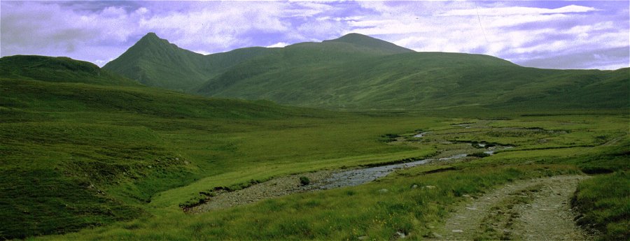
There is a vast and wild area behind the Ullapool to Grave road. Wyvis Forest with Ben Wyvis to the north east of Garve, Inverlael Forest with Beinn Dearg at the head of Loch Broom, Rhidorroch Forest and Freevater Forest to the east of Ullapool. Whilst this northerly section does not hold such large mountains (Dearg and Wyvis to the south both top the 1000m contour) the solitary Munro of Seana Bhraigh is found right at its heart. Single day outings to reach the tops of these mountains are major expeditions involving many miles of approach and return and as a result we had not explored the area at all. Tracks and paths run up several of the glens which makes the region an obvious target for a few days of backpacking, allowing time to explore the glens and views more or less at leisure. With so few major mountains and no 'formal' long distance routes a la West Highland Way, visitors are more akin to explorers and are most unlikely to come across any large groups of other walkers.
Before Ullapool was established and became the modern day centre for the region the original focus of habitation was at Inverlael at the head of Loch Broom. An old path headed North East from here, through what is now a forest plantation to cross the broad hills to the upper reaches of Glen Douchary, across this valley to skirt a further shoulder before descending the full length of Strath Mulzie. This leads through to Oykel Bridge. However the path has been lost over the first highland section and any crossing on this route must tackle a long section of trackless moorland before picking up the modern land rover track above Strath Mulzie. As infrequent practitioners of backpacking we did not fancy the prospect of such hard going and so we turned our attention to the easier access routes further north. This provides a straight forward passage to the north east and Oykel Bridge, however the need to get back to the car left at Ullapool is crucial and there is no obvious public transport to do this. Walkers who are able to undertake one-way routes, or who are prepared to across high ridges and pathless moor will be able to plan a walk across the region. However for us a loop into the heart of the region using Glen Achall as the approach and return paths seemed the offer the most appropriate opportunity for a first exploration.
The plan was one of gentle exploration, taking in the bothies at Knockdamph (Loch an Daimh) and Loch a' Choire Mhoir in the heart of the mountains. At this stage no real thought was given to climbing on to the higher tops and ridges.
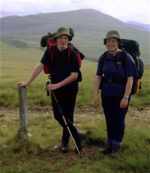
We had set off from home for Achiltilbuie on the Saturday and pottered
about on Sunday prior to a three or four day exploration of Rhidorroch and
Freevater Forests. Rucksacks were packed, food divided between the four of us
and tents taken down and stowed. We dropped a note in at the Police Station in
Ullapool and parked the car in the central car park. The entrance to Gen Achall
is reached along the Ullapool River that flows under the main road to the north
of the village. The access road serves the local quarry and the entrance is
both busy and substantial. This section can be bypassed by taking the hillside
path above Ullapool - but the prospect of the steep climb at the start of the
walk with full packs did not appeal.
Day One - Loch Achall and
Knockdamph
Day Two - Duag Bridge
and Loch a' Choire Mhoir
Day Three
- Seanna Bhraigh and back to Knockdamph
Day Four - Return to Ullapool