| Summit: | Sgurr a' Ghreadaidh |
| Heights: | 973 m (3192 ft) |
| Map Reference: | NG 445 233 |
| Maps: |
|
| Our Ascents: |
This was the first walk on the Skye Ridge at the start of a full week and therefore this was more of an exploration and acclimatisation to the Cuillin terrain. Starting from the Glen Brittle road at the Yout Hostel we followed the rising path over heather towards Coire a' Ghreadaidh. The weather was hot and sunny and we rested beside the slab waterfall at the river crossing having gained the first 1000 ft of ascent.
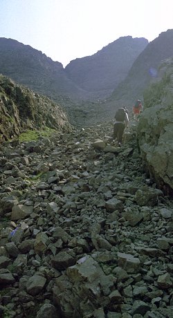
From the river the path follows a shallow ridge as it climbs into the smaller Coire An Dorus. The ground flattens slightly before starting a steep climb to the narrow gap in the ridge above. The path hugs the south buttress and ascends loose scree before reaching firm rock just below the narrow cleft that is the col. Beyond is a sharp drop and a long view down the entire length of Lock Coruisk. The descent down this side is not recommended. The height of this narrow col is 847 m (2,779 ft) and there is not alot of room to move around as on both sides the ridge rises sharply over more rock buttresses.
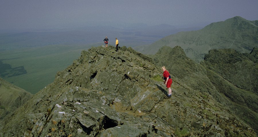
After a bite to eat we left the rucksacks and set off south along the ridge towards the summit. The start of the ascent is a moderate scramble to gain the ridge above; this required care but there was no need for a rope. The route eases as it follows the ridge past a great cleft that falls back into Coire a' Ghreadaidh, this cleft is named Eag Dubh - the Black Cleft. The scrambling continues over several crags towards a rather imposing buttress - The Wart. In fact this is easily turned by a simple path on the right and just beyond this is the summit cairn to the ridge is reached. The summit ridge to this mountain is extremely narrow and you get a real sense of height as you peer down either side. The cairn is sited on the north top and the ridge traverse continues along the knife edge towards the obvious sout top ahead. This further top appears to be slightly higher however we were reassured by our guide that this was not the case. Later with the aid of the map we established that the southern top is indeed lower but only by the modest height of 4 m - a difference impossible to judge on the hill.
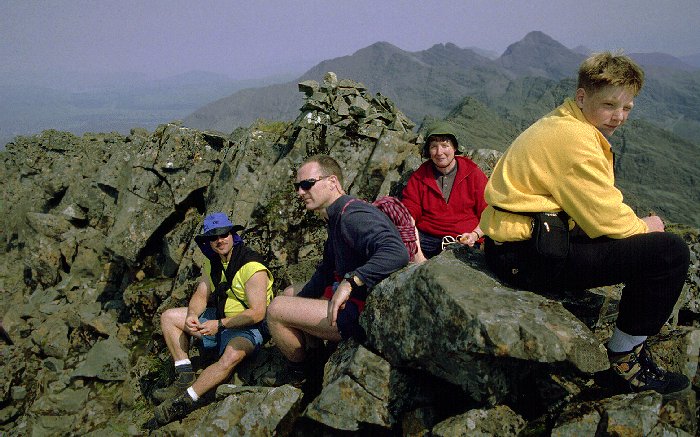 The entire
Cuillin ridge was in view - although a bit hazy. Far below to the south east
was Coruisk, with the coastal route from Elgol that we had walked the previous
day looking even further away. We could see the passenger ferry crossing
Loch Scavaig to drop tourists at the entrance to Coruisk.
The entire
Cuillin ridge was in view - although a bit hazy. Far below to the south east
was Coruisk, with the coastal route from Elgol that we had walked the previous
day looking even further away. We could see the passenger ferry crossing
Loch Scavaig to drop tourists at the entrance to Coruisk.
After a rest and the taking of several photos we returned along the ridge and dropped back into the col of An Dorus and the rucksacks. Before returning home we included the climb to Sgurr a' Mhadaih.