| Features: | The Prison, The Needle, The Table |
| Map Reference: | NG 454 690 |
| Maps: | OS Landranger Sheet 23: North Skye (1:50,000) |
| Our Ascents: | 4 August 1999 |
We had had four hot and sunny days in succession on the hills, the previous two on the high ridges of the south Skye, and we opted for a 'day off' mid-week in the hope of two more full days on the Cuillin ridge. The attraction of as easy stroll to a hill without the need to climb was obvious and an intriguing proposition as far as Andrew was concerned.
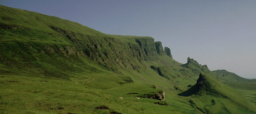
By taking the narrow side road west from Staffin you can take the car to the top of the long ridge that runs through the north of Skye. Parking by the roadside you are left with an easy and level stroll of just over 1 km at the foot of the cliffs. The weather was obviously going to be a scorcher with hazy views in a modest breeze. The first set of crags reached on the right is The Prison and we clambered up round the back to reach the top of the highest pinnacle.
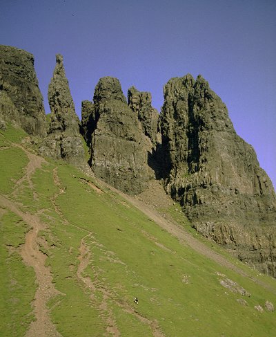
Opposite and at the top of a steep grassy bank is The Needle, a tall and narrow pinnacle standing well forward of the cliffs behind. Completing the circle of The Prison we then climbed the steep bank, past the foot of The Needle, to enter an array of pinnacles in search of the famous feature of The Table. Climbing up through a cleft in the rocks we eventually found it perched 100 ft or so below the cliff ridge. This expanse of flat and green grass hidden away high amongst crags and pinnacles is a remarkable place. According to the guide books the locals used to play a shinty match up here - Susan thought it must have been a ploy to ensure the opposition was knackered before they started - Andrew wondered who had to fetch the ball.
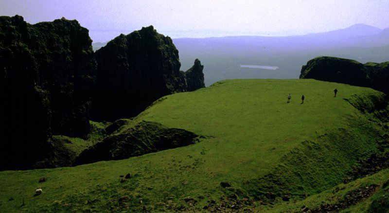
We stretched ourselves out in the hot sunshine and took in the views of
the east coast. Despite the secluded approach to this haven it is not a
private place - there was a constant procession of people peering down on
us from the cliffs above. The option to make a circular walk and return
along the top of the cliff edge requires a walk of a further 1 km
northwards to reach a scalable breach in the cliffs. We ignored this and
picked our way back down through the pinnacles and descended the steep
grass slope to pick up the outward path. Andrew dislodged a couple of
stones which bounched furiously down the slope - scattering a group of
tourists standing at the bottom.
Once back at the car we toured to Uig on the west coast for a drink and late lunch before returning to Portree and a short rest.